District Overview

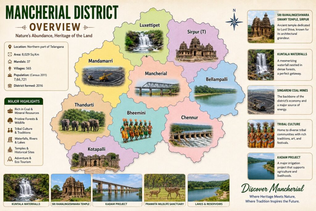
Mancherial District is one of the prominent districts in the state of Telangana, formed on 11 October 2016 during the state’s administrative reorganization. Located in the northern part of Telangana along the banks of the Godavari River, Mancherial is known for its rich coal reserves, industrial significance, lush forests, wildlife, historical temples, and scenic landscapes. The district plays a vital role in Telangana’s economy through its mining and power generation industries while also preserving its natural and cultural heritage.The district is home to the famous Singareni Coal Mines, which have been the backbone of the region’s economy for decades. Mancherial also features several popular tourist attractions, including the historic Sri Ramalingeshwara Swamy Temple at Velala (near Chennur), the scenic Kawal Tiger Reserve, the beautiful Kadem Project Reservoir, and the majestic Kuntala Waterfall, one of Telangana’s highest waterfalls located near the district boundary. With its blend of industrial development, wildlife, temples, rivers, and eco-tourism destinations, Mancherial offers visitors a unique experience where nature, history, and progress come together.
Mancherial District
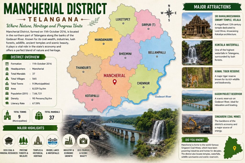
Mancherial District, located in the northern part of Telangana, is a rapidly developing district that combines urban growth with rural landscapes. The district comprises two major municipalities—Mancherial and Bellampalli—along with several towns and villages spread across its mandals. The region is known for its coal mining industry, fertile agricultural lands, forests, and the scenic banks of the Godavari River, making it an important economic and cultural center in northern Telangana.Mancherial Town, the district headquarters, serves as the administrative, commercial, educational, and transportation hub of the district. It is well connected by road and rail, making it a gateway to major attractions such as the Singareni Coal Mines, Sri Ramalingeshwara Swamy Temple (Velala), Kawal Tiger Reserve, Kadem Project Reservoir, and nearby Kuntala Waterfall.
Formation of Mancherial District
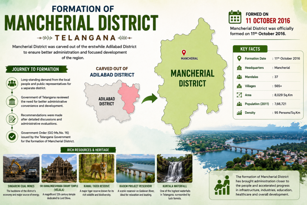
Mancherial District was officially formed on 11 October 2016 as part of the administrative reorganization of districts in Telangana. The district was carved out of the erstwhile Adilabad District to ensure better governance, efficient administration, and improved delivery of public services to the people.Established with its headquarters at Mancherial Town, the district is known for its abundant coal reserves, the historic Singareni Collieries, the scenic Godavari River, lush forests, and significant cultural and religious heritage. Mancherial is also home to important attractions such as the Sri Ramalingeshwara Swamy Temple, Kawal Tiger Reserve, Kadem Project, and nearby Kuntala Waterfall. Today, the district stands as one of Telangana’s major industrial and economic hubs while preserving its rich natural resources, wildlife, and historical legacy.
Population of Mancherial
Mancherial district has a total population of 7,66,721 according to the latest available Census-based data. The district has a balanced demographic composition, with 3,85,201males and 3,81,520 females, reflecting a healthy gender distribution. Approximately 56.3% of the population lives in rural areas, while 43.7% resides in urban areas, highlighting a blend of agricultural villages and rapidly developing towns. The district is home to people from diverse cultural, linguistic, and social backgrounds, contributing to its vibrant community life. With ongoing improvements in education, healthcare, infrastructure, and employment opportunities, Mancherial continues to experience steady population growth and overall socio-economic development.
Literacy, Rural & Urban Statistics
Get detailed information on Mancherial district’s population, including literacy rate, rural and urban population, gender ratio, child population, and demographic trends.
56.3%

Rural Population
43.7%

Urban Population
64.35%

Literacy Rate
Area and Measurement
Mancherial district covers a geographical area of approximately 4,016 square kilometres, making it one of the prominent districts in northern Telangana. The district features a diverse landscape comprising fertile agricultural lands, dense forests, coal-bearing regions, rivers, and urban settlements. It is bordered by several districts and is strategically located along the banks of the Godavari River, contributing to its agricultural and economic significance. The district’s terrain supports farming, mining, forestry, and industrial development, making it an important contributor to the state’s economy. With its balanced mix of rural and urban areas, Mancherial continues to grow as a key administrative, industrial, and cultural hub in Telangana.
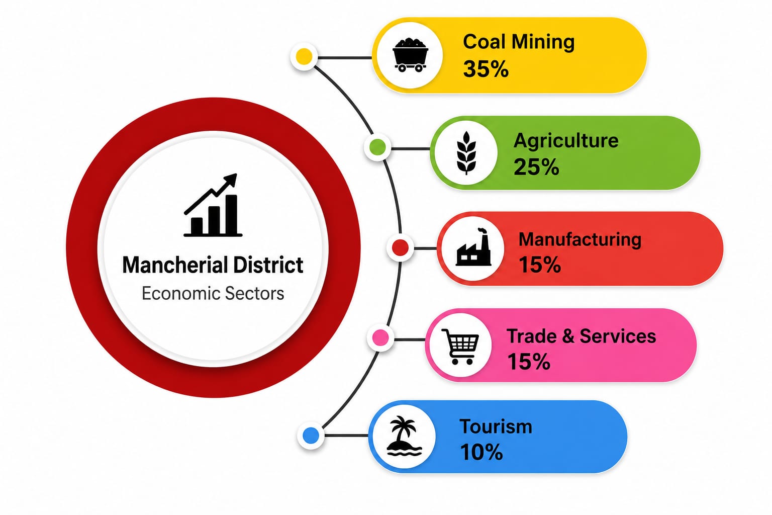
Revenue Sources of Mancherial District
Key Economic Highlights
- Coal Mining: The Singareni Collieries make Mancherial one of Telangana’s most important coal-producing districts.
- Power Generation: The Jaipur Thermal Power Plant contributes significantly to industrial activity.
- Agriculture: Paddy is the leading crop, while mango has been identified as the district’s One District One Product (ODOP) horticultural crop.
- Industries: The district hosts coal, cement, ceramic, rice milling, fly ash brick, solar power, and cotton-based industries, with 428 registered industrial units employing over 7,000 people.